
KNOWLEDGE
HUB
Discover research, data and practical resources to
inform decision-making and strengthen conservation
action across Africa
CONSERVATION RESOURCES
A collection of wildlife and habitat conservation tools and resources for anything
from school projects to Environmental Impact Assessments.
Find useful guides, handy links, trusted resources, and user-friendly tools. If you
don’t find the answers to your queries here, please ewt@ewt.org.za and we will
do our best to assist you.
Environmentally Responsible Development
Environmentally Responsible Development
- Environmental Impact Assessment (EIA) Online Guide
- Threatened Species No-Go Mapping Tool
- Guide to Downloading Mine & Renewable Energy Data
-
Pre-construction Monitoring of Bats
at Wind Energy Facilities -
Operational Monitoring of Bats
at Wind Energy Facilities - Know Your Environmental Rights
- Mitigation Hierarchy in South Africa
Reports for Decision Makers
Reports for Decision Makers
-
A Population Assessment of Lions in The Nxanatseni
South Region of Kruger National Park 2024 -
A Population Assessment of Lions in The Nxanatseni
North Region of Kruger National Park 2023 - Impacts of Noise Pollution on Marine Animals
- Captive Lion Report
-
The Role of NGO’s in Biodiversity Conservation
in South Africa - The State of South Africa’s Provincial Reserves
-
Opportunities for Protected Area Expansion & Ecosystems
Restoration in South Africa’s Strategic Water Source Areas
Useful Links
Biodiversity & Business
Biodiversity & Business
Wildlife and You
THE EWT’s PERSPECTIVES
Explore our perspectives on the decisions, developments and debates shaping conservation.
Explore The EWT’s Perspectives
Explore The EWT’s Perspectives
- African Penguin Socio-Economic Report
- Baited Shark Cage Diving
- Captive Carnivores
- De-extinction Perspective
- Dehorning of Rhino
- Global Biodiversity Frameworks
- Human Population Development
- Illegal Wildlife and Disease
- Intensive Wildlife Breeding
- Ivory Trade
- Legalising the Trade in Rhino Horn
- Multi-species Biodiversity and Management Plan
- Nuclear Energy in South Africa
- Predators and Farmers
- Renewable Energy Installations
- Shale Gas in South Africa
- Single-use Plastic
- Trophy Hunting
- Vulture Safe Zones
- Wind Energy Development
MAMMAL RED LIST
Explore the latest assessment of the conservation status of mammals
across South Africa, Lesotho and Eswatini.
About the 2025 Regional Mammal Red List
About the 2025 Regional
Mammal Red List
The Mammal Red List of South Africa, Lesotho, and Eswatini revision was coordinated by the Endangered Wildlife Trust (EWT) and the South African National Biodiversity Institute (SANBI). It forms part of a series of national Red List projects including assessments of Amphibians, Birds, Butterflies, Dragonflies & Damselflies, Fairy Shrimps, Freshwater Crabs, Freshwater Fishes, Mammals, Plants, Reptiles, Sharks, Sparids, and Spiders.
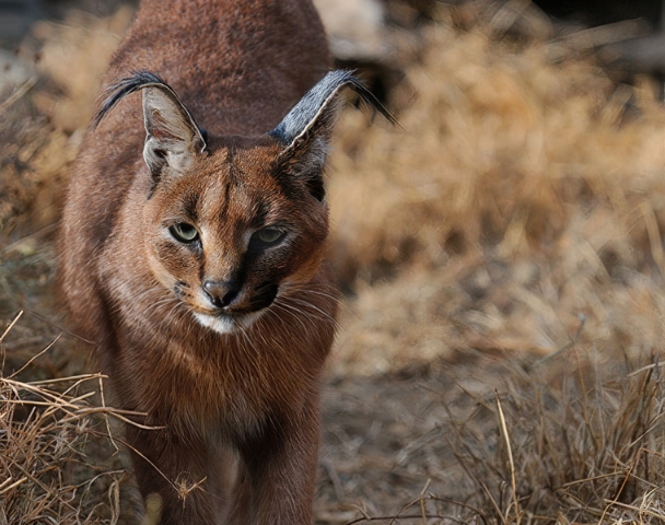
This Regional Red List provides an up-to-date assessment of the conservation status of our mammals, of which 67 (~20%) are deemed to be threatened with extinction, and 39 (11.5%) are Near Threatened.
Assessment Highlights
Assessment Highlights
11 species were uplisted to higher threat categories in this revision, while three species were downlisted. The main threats were identified as habitat loss and degradation due to agricultural and urban expansion, climate change and extreme weather conditions, as well as over-exploitation and poaching.
Of the 336 taxa assessed, 67 are endemic to the assessment region. 28 (42%) endemic mammals are threatened with extinction, making the country fully responsible for their protection.
A large proportion of mammals are Well Protected within the South African Protected Areas Network; however, 25% of mammals are Poorly Protected or Not Protected, and need intervention to increase their protection level.
336
TAXA
EVALUATED
20%
THREATENED
WITH EXTINCTION
11.5%
NEAR
THREATENED
Acknowledgments
Acknowledgments
Building on the 2016 Mammal Red List, the 2025 revised assessments were based on data and expertise from 163 experts.
Thank you to all the Data Providers that contributed data, making it possible to revise the assessments.
The 2025 Mammal Red List revision was funded by SANBI (via the French Development Agency (AFD and FFEM)), De Beers Group, Eskom and the Leiden Foundation.

Contact us for more information
Contact us for more information
Dr Tamanna Patel
Mammal Red List Coordinator
The Endangered Wildlife Trust
Domitilla Raimondo
Threatened Species
Programme Manager
Biodiversity Research
and Monitoring
South African National
Biodiversity Institute
IUCN Red List Committee
LAND USE DECISION SUPPORT TOOL
FOR SPECIES OF CONSERVATION CONCERN
South Africa’s exceptional biodiversity makes conservation essential. This tool identifies areas
most sensitive to development and critical for species conservation.
Background
Background
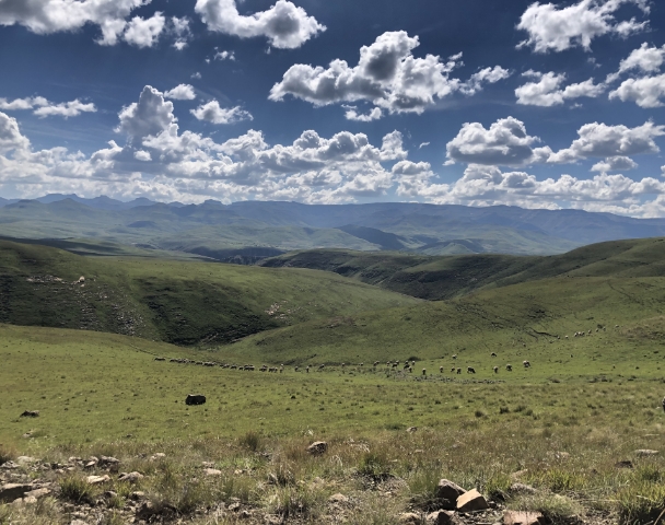
South Africa is one of the world’s most biologically diverse countries, boasting a remarkable level of endemism across its ecosystems. Despite covering only 2% of the Earth’s land surface, the country harbours over 95,000 species. To conserve this unique biodiversity, it is essential to identify areas that are highly sensitive to development, particularly those that support species of conservation concern.
Contact Support: Assistance for technical or data-related issues: science@ewt.org
About the LUDS Tool
About the LUDS Tool
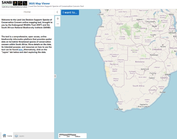
The Land Use Decision Support Tool for Species of Conservation Concern (LUDS SCC Tool) is an online, open-access biodiversity informatics platform developed by the Endangered Wildlife Trust (EWT) in collaboration with the South African National Biodiversity Institute (SANBI). It provides spatial data on threatened terrestrial biodiversity to help decision-makers, Environmental Assessment Practitioners (EAPs), and developers identify and avoid areas of high ecological sensitivity early in the planning process.
Using the LUDS SCC Tool
Using the LUDS SCC Tool
Purpose
Purpose
The LUDS Tool helps users:
- Identify areas of very high biodiversity sensitivity using up-to-date plant and animal data.
- Support early-stage project design by integrating biodiversity considerations before EIA commencement.
- Encourage avoidance and mitigation as the first steps in the environmental decision-making hierarchy.
- Reduce unnecessary costs and prevent irreversible biodiversity loss.
How it Works
How it Works
The tool allows users to:
- Access biodiversity data via an interactive map hosted on the SANBI platform.
- Filter information by theme, species group, scientific name, and IUCN Red List category.
- Draw or upload an area of interest to generate a biodiversity report identifying species of conservation concern within that area.
- Download a comprehensive report, including species lists, maps, and threat categories.
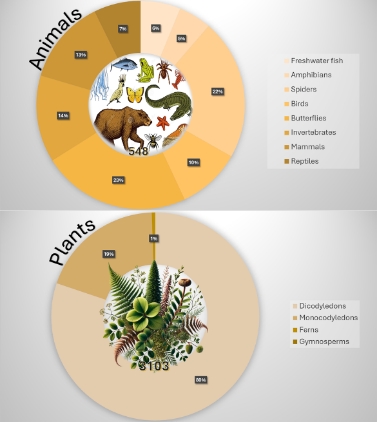
- The database currently includes over 3,650 species: 3,103 plants and 549 animals, with annual updates planned to ensure accuracy and relevance.
Who Should Use this Tool
Who Should Use this Tool
The LUDS SCC Tool is designed for:
- The general public with an interest in Biodiversity.
- Environmental Assessment Practitioners (EAPs) and Specialists conducting EIAs.
- Developers and planners identifying suitable sites.
Researchers and conservation agencies requiring biodiversity spatial data. - Policymakers and consultants integrating biodiversity considerations into decision-making.
Species Data and Sensitivity Levels
Species Data and
Sensitivity Levels
Species included in the LUDS Tool meet one or more
of the following criteria:
- Listed as Critically Endangered, Endangered, Vulnerable, or Near Threatened on the IUCN Red List.
- Classified as Critically Rare or Rare according to national assessments.
- Each species is mapped with an associated sensitivity level, highlighting the relative importance of its habitat within the landscape.

Collaboration and Data Sources
Collaboration and Data Sources
The tool represents a collaboration between:
- Endangered Wildlife Trust (EWT)
- South African National Biodiversity Institute (SANBI)
- BirdLife South Africa
Together, these partners have integrated comprehensive species data to support evidence-based conservation and sustainable development.
Contribute
Contribute
Help us keep the tool up to date. If you have verified spatial data on species of conservation concern or would like to collaborate, please contact the EWT’s Biodiversity Information Team at: science@ewt.org
Help and Resources
Help and Resources
Introduction Video
Discover the LUDS SCC Tool, an online platform by the EWT and SANBI that provides spatial biodiversity data for threatened species across South Africa, helping users make informed, conservation-driven land use decisions.
How to Generate a Biodiversity Report
Learn how to generate a biodiversity report using the LUDS SCC Tool, developed by the EWT and SANBI. This step-by-step guide shows you how to draw your area of interest, apply filters, and download or email your biodiversity report, helping you make informed, conservation-conscious land use decisions.
How to Download Spatial Data for Offline Use
How to use the Query function
Other useful resources
THREATENED SPECIES NO-GO MAPPING TOOL
Identify areas of very high biodiversity sensitivity and avoid development
that could threaten species of conservation concern.
Background
Background
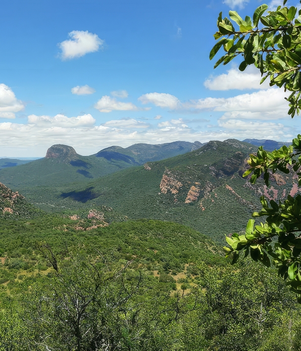
South Africa is considered one of the most biologically diverse countries in the world. It has a high rate of endemism and diverse ecosystems. While it occupies only 2% of the world’s land surface area, South Africa is home to over 95,000 species, contributing a significant proportion to world plant species (6%), reptile species (5%), bird species (8%) and mammal species (6%), with more species regularly discovered and described. To conserve this biodiversity, it is important to understand which areas are considered threatened species no-go areas.
The Department of Forestry, Fisheries, and the Environment (DFFE) has established an online, open-access national Environmental Screening Tool (EST). Since 5 July 2019, by law, a report generated by the screening tool must accompany all environmental impact assessments (EIAs).
The No-Go Mapping Tool
The No-Go Mapping Tool
Using the underlying data from the Environmental Screening Tool (EST), we have created a Threatened Species No-Go mapping tool. Our tool builds on the EST’s foundation to fill several important gaps, primarily by identifying areas where approving a development could significantly affect biodiversity, especially species of conservation concern. DFFE does not legally mandate these Threatened Species No-Go areas, but prospective developers should prioritise avoiding them because of their high sensitivity.
The EST screens for a broad range of environmental sensitivities, including terrestrial plant and animal biodiversity. We have collaborated with the South African Biodiversity Institute and BirdLife South Africa to develop the species data that feeds into the screening tool.
We include species of conservation concern that the IUCN Red List of Threatened Species or South Africa’s National Red List website lists as Critically Endangered, Endangered, or Vulnerable under the IUCN Red List Categories and Criteria, version 3.1.
The screening tool currently represents over 422 animal and 4,600 plant species.
Using the No-Go Tool
Using the No-Go Tool
The Department of Forestry,
Fisheries, and the Environment’s
Environmental Screening Tool
The DFFE’s screening tool was created to:
- streamline and simplify the EIA process by providing timeous, succinct, and robust reports
- ensure ongoing improvements to the efficiency and effectiveness of the EIA process
- enable applicants to avoid sensitive sites by manipulating the development footprint on a site, to avoid environmental sensitivities
- identify upfront any specific exclusions, restrictions, prohibitions or exceptions to the EIA process that apply to a particular site.
The screening tool also informs early-stage decisions around avoidance, minimisation, specialist requirements and, in some cases, it facilitates early rejection which ultimately saves money and effort.

Purpose
Purpose
This is a national scale application which informs prospective developers, Environmental Assessment practitioners and/or the general public about areas of very high sensitivity biodiversity importance based on threatened animal and plant data. The intended purpose of the tool is to inform the placement of proposed potentially detrimental developments in order to encourage early-stage rejection or avoidance before EIA commencement and in this way avoid unnecessary cost to the developer, the responding interested and affected parties (especially conservation agencies), and as a result reduce irreversible loss/risk to the environment. There has been hesitancy to identify areas which are highly unsuitable for development and this application aims to address this directly. This online app allows for rapid assessment of site sensitivity to inform the first stage of the mitigation hierarchy, that being avoidance. The tool is intended to be a reference tool for prospective developers, EAPs and I&AP’s and should be used utilized in the project design stage to inform placement of development options and alternatives.
How it Works
How it Works
Accessing the map
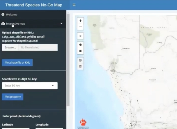
To get started, click on the “Interactive map” menu item in the sidebar. The default view of the map displays all of the threatened species no-go areas. Zoom in to look at these features more closely. Hover over the feature to display more information.
Viewing layers
The panel on the right shows a number of layers that can be toggled on/off. At the top are three base layers showing either a topographic, street, or satellite imagery view. Below those are the data layers which include the no-go areas, which can be turned on/off, the protected area layers and the farm portions, and ERFS from the cadastral data.
Running queries
There are four ways to query the map with your own spatial data: you can either upload a shapefile/KML file, enter a Survey General 21 digit property code, enter a latitude or longitude point, or manually draw a polygon directly on the map.
In order to view further details about the species that are flagged as no-go and the properties that they occur in, click on the “Data table outputs” sidebar menu item.
This page has four tabs that correspond to each of the spatial input methods. Click on each one as needed. Each tab has a “Species” table, where details of the no-go species are listed, and a “Property” table, which contains the details of properties in which a species or group of species is found. The download button can be used to export the tables in an Excel CSV format.
There is also an option to plot all of the no-go polygons of a specific species. Navigate back to the “Interactive map” sidebar menu item and scroll to the “Species” dropdown list. Here you can either select a species from the list or start typing to bring up the matching species. Click plot to view the entire species layer, which can also be toggled on/off.
Who Should Use this Tool
Who Should Use this Tool
In this threatened species no-go area tool we build on the foundation of the environmental screening tool to fill a number of important gaps. The No-Go areas are informed by the same underlying data that inform the EST but only the most sensitive subset of these. The resultant No-Go areas should be treated as priorities for avoidance given their importance for conserving highly localized species of conservation concern. The EST does not explicitly highlight these areas from a development avoidance perspective but due to their level of sensitivity, this tool provides an easily accessed and user-friendly portal for prospective developers, Competent Authorities and Environmental Assessment Practitioners to identify No-Go Areas at the onset of the scoping phase for any given development. It also allows the easy identification of alternative sites, through the ability to assess landscapes including multiple properties, to avoid No-Go Areas. This is also a useful tool for identifying species focused protected area expansion priorities for conservation authorities and NGOs.
How are the No-Go Areas Defined
How are the No-Go Areas Defined
The data included in this national scale map are a subset of the data included in the EST terrestrial animal and plant sensitivity layers. We followed a three-step process to filter the screening tool data in order to identify our threatened species no-go areas.
First, we included only data from the Very High or High sensitivity categories.
Second, we kept only species which were Red Listed under the IUCN’s criteria B, C, and D. This ensures that the species included are facing threats directly related to habitat transformation and loss.
Third, we calculated the total geographic area of the polygons in the screening tool layers and retained species which had a total of less than or equal to 25km2. This therefore identifies species for which we have confirmed occurrence records from an extremely restricted area. Not all species are included in the EST tool and the No-Go tool, and thus users should not assume that an absence on a No-Go report necessarily reflects a true absence in the field.

Species Summaries
Species Summaries
Number of species in each group included in the No-Go map
| Theme | Class or taxa | Number of species |
|---|---|---|
| Animals | Amphibia | 15 |
| Animals | Arachnida | 4 |
| Animals | Aves | 2 |
| Animals | Insecta | 59 |
| Animals | Invertebra | 5 |
| Animals | Mammalia | 20 |
| Animals | Reptilia | 7 |
| Plants | 1747 |

Sensitivity Levels
Sensitivity Levels
The spatial data in the mapping tool are assigned one of two sensitivity levels:
Areas of Very High sensitivity represent critical habitat for range-restricted species of conservation concern that have a global range of less than 10 km2.
High sensitivity areas are those with recent (post-2002) confirmed habitat for species of conservation concern.
Contribute
Contribute
Please contribute your data to improve and maintain the EST and No-Go tools.
Any records of threatened species collected during EIAs and by specialists during surveys are of high value in terms of developing species distribution models and understanding the range of our threatened species. Based on the gazetted species protocol, species records need to be uploaded onto a virtual museum platform. This is not yet available.
You are the experts and we value your input to improve the robustness of this tool.
* The EWT will compile all external data submitted into a central database which will be shared with SANBI and will be incorporated into the EST. Data housed on the EWT database can be accessed via a data request.
Help and Resources
Help and Resources
Please contribute your data to improve and maintain the EST and No-Go tools.
Any records of threatened species collected during EIAs and by specialists during surveys are of high value in terms of developing species distribution models and understanding the range of our threatened species. Based on the gazetted species protocol, species records need to be uploaded onto a virtual museum platform. This is not yet available.
You are the experts and we value your input to improve the robustness of this tool.
* The EWT will compile all external data submitted into a central database which will be shared with SANBI and will be incorporated into the EST. Data housed on the EWT database can be accessed via a data request.
- Environmental Screening Tool
- Government Gazette of the Terrestrial Plant Species and Terrestrial Animal Species protocols
- Species environmental assessment guideline: Guidelines for the implementation of the Terrestrial Flora (3c) & Terrestrial Fauna (3d) Species Protocols for environmental impact assessments in South Africa
- Understanding SG codes – http://csg.dla.gov.za/21charac.htm
- Endangered Wildlife Trust – https://ewt.org
- SANBI – https://www.sanbi.org/
Data Disclaimer
Data Disclaimer
This tool is based on biodiversity data alone and does not inform No-Go areas on the basis of other triggers such as cultural heritage or ecosystem services. Even though we are fortunate to have access to one of the world’s most robust and comprehensive biodiversity datasets, we recognise that, in some instances, species presence data may be outdated as shifts in landuse or species distribution may have occurred within the past twenty years. In these instances, we would value the submission of updated data to improve the tool to be emailed to us.
MITIGATION HIERARCHY
Explore practical guidance for avoiding, minimising, rehabilitating
and offsetting the environmental impacts of development.
The Mitigation Hierarchy in South Africa
The Mitigation Hierarchy
in South Africa
While Africa is undergoing a necessary development trajectory, poorly-planned infrastructure projects can have disastrous impacts on biodiversity, the ecosystem services on which many people rely, and the economic sustainability of the projects themselves. The mitigation hierarchy addresses this problem by requiring that a project’s significant negative environmental impacts are anticipated and sequentially avoided, minimised, rehabilitated, and/or offset.
South Africa’s environmental laws and policies call for a hierarchical approach to impact mitigation. However, it is widely acknowledged that various challenges frequently prevent the aims of the mitigation hierarchy from being achieved in practice. The Endangered Wildlife Trust, BirdLife South Africa and Enviro-Insight are collaborating to develop Best Practice Guidelines for Implementing the Mitigation Hierarchy in South Africa.


Best Practice Guidelines: Implementing the Mitigation Hierarchy
Best Practice Guidelines:
Implementing the Mitigation Hierarchy
These Guidelines will support the improved implementation of the mitigation hierarchy by specialists, environmental assessment practitioners, and developers. They will also enable competent authorities to better assess adherence to the mitigation hierarchy in projects seeking environmental authorisation and assist them in setting robust licencing conditions to hold developers accountable for implementing mitigation activities.
The project’s first stage has now been completed, and a literature review and draft guideline framework were produced. These outputs were workshopped with government representatives and South African and foreign experts. The drafting process is now underway, and it is envisaged that a full draft of the Guidelines will be ready for further consultation in early 2023. Once the Guidelines are finalised, a training programme will be undertaken to support their utilisation, and several more concise products will be distilled from the Guidelines for individual target audiences.

Mitigation Hierarchy Training Videos
Mitigation Hierarchy Training Videos
- Session 1: Introduction and Background
- Session 2: The Mitigation Hierarchy and Significance Assessment
- Session 3: The Preventative Component of the Mitigation Hierarchy
- Session 4: The Remediative component of the Mitigation Hierarchy
- Session 5: Applying the Mitigation Hierarchy in EIA Reports and Conditions of Authorisation
CYCADS
Cycads are ancient seed plants with a history stretching back 280 million years.
Often mistaken for palms or tree ferns, they produce cones rather than flowers
and were abundant during the Jurassic period, known as the “Age of Cycads”.
They have survived three mass extinctions, but human activity has now brought
these remarkable plants to an extinction crisis in South Africa. Illegal collection
from the wild and habitat loss threaten their survival, placing plants with an
extraordinary evolutionary history at risk of disappearing.
Threats to Cycads in South Africa
Threats to Cycads in
South Africa
South Africa is a hotspot for cycad diversity, with 38 indigenous species (over 10% of the world’s cycads). Thirty seven of these species belong to the genus Encephalartos of which more than 70% face extinction. Illegal harvesting from the wild is the most significant threat to indigenous cycad species and is driven by the local and international demand for plants to use in private gardens and collections.

Cycads and the Law
Cycads and the Law
According to national environmental legislation, the trade in Encephalartos cycads taken out of the wild is prohibited. The following national laws regulate biodiversity and provide protection for various species, including cycads:
- National Environmental Management: Biodiversity Act 10 of 2004 (NEMBA), read with
- Threatened or Protected Species (TOPS) Regulations, 2007,
- Convention on International Trade in Endangered Species of Wild Fauna and Flora (CITES) Regulations 2010. CITES applies when listed species are subject to import or export-related activities, and this includes specimens, parts and derivatives of all cycad species.
- National Environmental Management: Protected Areas Act 57 of 2003 (NEMPAA) protects all biodiversity in protected areas.
Each province also has conservation laws to further protect and regulate cycad trade.

Obtaining Cycads Legally
Obtaining Cycads Legally
There are legal methods of obtaining and keeping artificially propagated cycads. If you are in possession of an indigenous Encephalartos cycad, or if you want to purchase one, you need to obtain a permit. This will help to protect these threatened species from illegal trade. If you are in possession of an exotic cycad, you may not need a permit. To find out what the requirements are for your area, or if you have any other queries, please refer to the relevant contact details below.

How to Identify a Cycad
How to Identify a Cycad
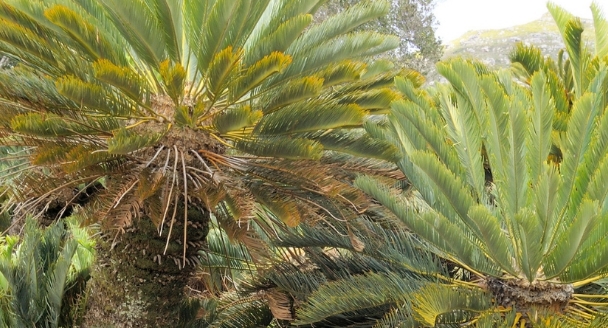
South Africa is home to numerous Encephalartos species, each with its own distinct features. Encephalartos Cycads are often confused with palms and tree ferns and can be difficult to identify. Here’s how to check if you have an Encephalartos cycad in your garden. If you are still unsure or have any other queries, please refer to the relevant contact details below.
When identifying Encephalartos cycad species in South Africa, the following key features are commonly considered:
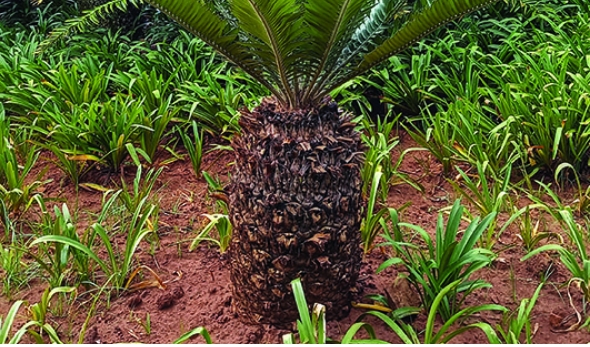
The trunk
Encephalartos Cycads have cylindrical trunks that do not usually branch. The trunk may be buried with the leaves appearing to be emerging from the ground.
Encephalartos trunks have spirals of relatively smooth diamond-shaped leaf scars

Leaves
Encephalartos leaves grow directly from the trunk in a whorled formation, and typically fall as they get older, leaving a crown of newer leaves at the top. Leaves have leaflets arranged on either side of the stem.
Encephalartos leaflets have sunken, parallel veins and no mid vein. If there is a mid vein, it is not an Encephalartos species. Leaflets are hard and prickly and don’t bend easily. They may be green, blue-green, or grey.


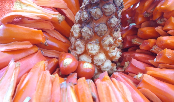
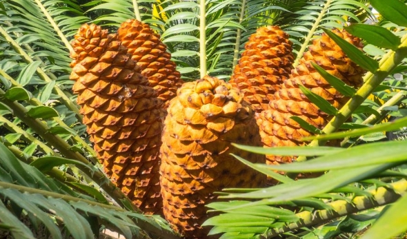
Plant reproduction
If the plants are in reproductive condition, there is no possibility of confusing them with palms because cycads bear large, conspicuous cones but no flowers, whereas palms bear small inconspicuous flowers.
Contact Details for Information & Permits
Contact Details for
Information & Permits
National hotline
Report cycad theft to the National Environmental Crimes
and Incidents Hotline

National
The Department of Forestry, Fisheries, and the Environment
General enquiries:
086 111 2468
Switch board:
012 399 9000
DFFE-TOPS & CITES Permits
012 399 8818
The EWT Wildlife in Trade Programme
witinfo@ewt.org.za
Provincial
Eastern Cape
045 808 4000
Free State
051 404 9600
Gauteng
011 240 3184
KwaZulu-Natal
033 845 1654
Limpopo
015 297 3839
Resources

RESEARCH & DATA
Explore conservation research priorities and biodiversity data.
Priority conservation research questions for prospective students
Priority conservation
research questions for
prospective students
Help us answer the questions that shape conservation action. We’ve identified priority research topics where students can contribute to practical solutions for wildlife, landscapes and people across Africa.
Explore the topics below and contact the relevant manager to discuss your research interests. We do not currently offer funding for these projects.

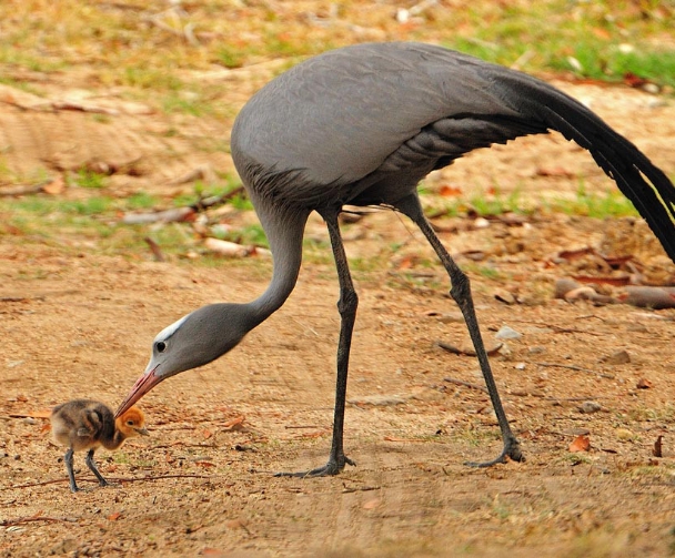
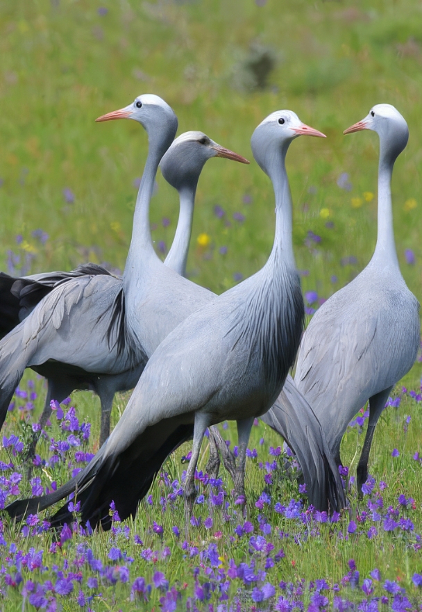
African Crane Conservation: Blue Cranes in the Western Cape
African Crane Conservation:
Blue Cranes in the
Western Cape
Keywords/themes: breeding biology, anthropogenic threats, climate change

- How does Blue Crane breeding success vary across the Overberg, and what are the potential drivers of this?
- How sensitive are breeding Blue Cranes to changes in temperature, and how will this affect the resilience of the Western Cape populations in the face of climate change?
- How much crop damage are Blue Cranes (and other large birds) responsible for in the Swartland and Karoo agricultural regions? Are crop protection methods, such as using a non-lethal crop treatment (e.g. Anthroquinone), effective in deterring cranes?
- What are the characteristics of roosting sites used by cranes across their range, and how sensitive are these to threats? How do activity patterns of cranes change around nests, and how far do adults forage from nests? This information can help guide appropriate conservation action necessary to protect roost sites and limit human disturbance.
African Crane Conservation: Wattled and Crowned Cranes
African Crane Conservation:
Wattled and Crowned Cranes
Keywords/themes: breeding biology, anthropogenic threats, climate change

- How much suitable breeding habitat is available for Wattled Cranes in South Africa, and how vulnerable are these habitats to anthropogenic impacts?
- What do we know about the movement ecology, breeding biology and success, and the extent and impact of threats such as power line collisions, illegal trade, and habitat loss on South Africa’s Grey Crowned Crane population?
- What are the impacts of human disturbance on Grey Crowned Crane breeding productivity in east Africa?
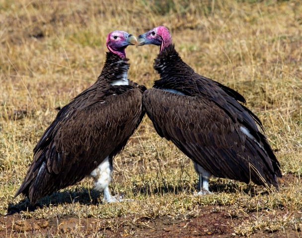
Birds of Prey: Vultures
Birds of Prey:
Vultures
Keywords/themes: movement ecology, poisoning, breeding biology

- Are the Vulture Safe Zones improving the breeding success and population trends of South Africa’s threatened vultures?
- Using previous results of habitat suitability models, can we identify suitable and safe sites to support an active Bearded Vulture (Gypaetus barbatus) captive rearing and recovery programme?
- Since 2006, the EWT has been coordinating the vulture tagging and resighting database in southern Africa. Using this long-term database, we would like to address the following questions:
- Are there any negative effects of using patagial wing tags (with respect to breeding success and productivity), and should we use new, less invasive colour tags?
- Can wing tags effectively determine survival and dispersal in individuals through resighting records?
- What is the average longevity of wing tags on vultures? Does this vary between species?
- Are landowners and/or members of the public more likely to report the presence of vulture carcasses to the EWT if they are wing tagged and/or ringed? What does this mean for population monitoring?
- What is the nest site occupancy and breeding success of Critically Endangered White-backed Vultures in the Kalahari?
- What are the baseline levels of lead ingestion and poisoning in Lowveld vultures?
- Vultures have the potential to act as long-distance vectors of infectious diseases. What are the ecto- and endoparasite loads, the prevalence of HPAI and Newcastle’s Disease, basic health parameters, genetics, and microbiome of vultures?
Birds of Prey: Martial Eagles in the Karoo
Birds of Prey Programme:
Martial Eagles in the Karoo
Keywords/themes: movement ecology, poisoning, breeding biology

We aim to assess the population dynamics, breeding, spatial ecology and diet of Martial Eagles that breed on Eskom transmission lines in the central Karoo, South Africa. The mechanisms driving changes in population sizes, particularly outside protected areas, are poorly understood. Further research to elucidate the drivers of the Martial Eagle’s decline is imperative for conserving the species. We need to better understand the factors that influence Martial Eagle breeding, foraging and ultimately, population dynamics, both within and outside of protected areas of South Africa.
Birds of Prey: African Raptors
Birds of Prey:
African Raptors
Keywords/themes: movement ecology, poisoning, breeding biology
- What are the migratory routes and non-breeding range of Wahlberg’s Eagle (Hieraaetus wahlbergi)? What are the threats that could impact the species along its migratory flyway?
- What is the status of the over-wintering populations, movements and foraging habits of Lesser Kestrel (Falco naumanni) and Amur Falcon (Falco amurensis) populations in South Africa?
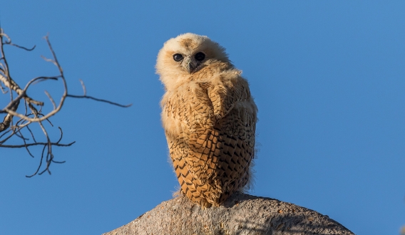
- What are the seasonal changes in Pel’s Fishing-owl territory occupation, foraging, and habitat use? These data will inform conservation interventions and protect known breeding and foraging sites.
- What are the levels of heavy metals in the eggshells of raptors in the Lowveld? This will help us use raptors as indicators of environmental health and provide a baseline level for the levels of different contaminants in the eggshells of birds of prey in Limpopo and Mpumalanga.
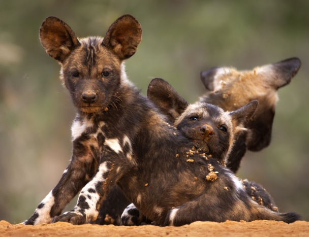
Carnivore Conservation: Understanding the ecology and conservation status of wild dogs
Carnivore Conservation:
Understanding the ecology and
conservation status of wild dogs
Keywords/themes: reintroduction planning, reintroduction success, human-wildlife conflict

- What is the historic distribution of Wild Dogs in Africa?
- What are the different population scenarios of wild dogs in the metapopulation when specifically focused on assessing regulatory mechanisms across a range of biotic and abiotic factors?
- What are the genetic relationships between Wild Dog populations in South Africa? This can be done through the construction of a national Wild Dog studbook that can be used to guide effective population management.
- What is the genetic diversity of Wild Dogs in Africa, and are there legitimate subspecies? This is vital as it will impact the selection of individual animals and sites for reintroductions.
- Using data from the Carnivore Conservation Programme, determine the population and current demographics (pride sizes, ages of dominant males, litter sizes, cub survival, etc.) of lions in the Greater Limpopo Transfrontier Conservation Area and assess whether these are representative of a healthy population? In addition, determine how factors such as prey movement and availability contribute toward seasonal lion density.
- Investigate what machine learning and citizen science methodologies are most effective for assessing the population and population trends of large carnivores.
- To improve our predator management plans, use data collected in metapopulation reserves (in South Africa) and in the predator guild reconstruction in Zinave National Park (Mozambique) to determine how reintroductions of large carnivores impact population dynamics of other large carnivores, smaller carnivores, and prey.
Carnivore Conservation: Understanding conservation needs of wild dogs in the context of metapopulations and boundaries of Protected Areas
Carnivore Conservation:
Understanding conservation needs of wild
dogs in the context of metapopulations
and boundaries of Protected Areas
Keywords/themes: reintroduction planning, reintroduction success, human-wildlife conflict

(issues surrounding where to reintroduce, how to make sure they establish, mitigate reintroduction and metapopulation-related problems)
- How do we refine the carrying capacity equations for large carnivores as developed by Hayward (Hayward, M.W., O’Brien, J., & Kerley, G.I.H. 2007a. Carrying capacity of large African Predators: Predictions and Tests. Biological Conservation 139: 219-229)? These models have high variability and are outdated, and current analysis techniques should allow for a more accurate set of equations.
- To identify suitable reserves for re-establishment of Wild Dog populations, and to support evidence-based Wild Dog management strategies, determine how Wild Dog demographics, population growth rates, and extinction rates differ under varying management regimes and intensities.
- What is the relative importance of pull factors (game farms with high densities of prey) and push factors (Lion density) in driving Wild Dog dispersal from protected areas?
- Does the density of apex predators impact the likelihood of Wild Dogs dispersing from protected areas? Is there a threshold of densities (e.g., of Lions) above which Wild Dogs disperse? How do pack, pride, and clan size impact the ability of Wild Dogs to safely coexist with apex predators? For example, perhaps large prides are easier to avoid than many small prides at the same density. This has implications for Lion and hyaena management when reserves want to keep Wild Dogs and Cheetahs.
- Our reintroduction feasibility assessments are currently based on educated guesses. By analysing data from past reintroductions, create an evidence-based assessment framework to illustrate what factors impact the successful reintroduction of Cheetahs and Wild Dogs.
Carnivore Conservation: Understanding and mitigating threats
Carnivore Conservation:
Understanding and mitigating threats
Keywords/themes: reintroduction planning, reintroduction success, human-wildlife conflict

(poisoning, snaring, retaliatory killing, road strikes, prey depletion, etc.)
- Does snaring have a quantifiable effect on wild dogs in Kruger National Park, and do snare removal projects reduce the effects of snaring on wild dogs?
- What are the most effective methods for reducing the levels of Human-Wildlife Conflict, and in what context and combination should they be used? In other words, how do we keep predators from killing livestock and high-value game? Many methods have been proposed and tried but without rigorous testing. For example, we need to understand the effectiveness of bio-boundaries, including the type of scent, longevity, and species it deters. We need long-term data collection on sympatric herds of livestock and adjacent game farms where a mitigation measure is applied to one farm or herd and not to the other. In this way, we will be able to validate methods and provide robust evidence-based recommendations to farmers, protected area managers, and government authorities.
- What are the most effective methods for reducing the perceived severity of human-wildlife conflict? In other words, how do we make farmers more tolerant when carnivores kill livestock and high-value game? This involves testing things like insurance schemes, ecotourism, community education, and financial incentives aimed at encouraging ethical farming. In combination with reducing actual losses to predators, this will help us to provide farmers with practical, evidence-based, holistic recommendations for farming in a predator-friendly manner.
- What is the role of human-wildlife conflict in Lion poaching for their parts? We do not expect that HWC is a driver of the Lion trade in and of itself. We suspect that when Lions are killed in retaliation for livestock losses, parts are then taken to sell. Career poaching and retaliatory killing require different investigative approaches and solutions. Understanding this relationship will help us to develop more effective approaches to address Lion poaching from a community level.
- Does the reintroduction of Leopards to the Karoo reduce HWC with caracals and jackals? This long-standing conflict seems to be caused by severe overpopulations in mesocarnivores due to the absence of apex predators.
- What is the impact of Livestock Guardian Dogs on apex predators and mesocarnivores? We must understand how Leopards respond to herds with LGDs versus those without LGDs. We also need to understand how LGDs impact other species like jackals and Caracals. This will give us evidence to determine how effective LGDs are in creating safe spaces for carnivores.
- Which livestock guardian animals (donkeys, dogs, alpacas, etc.) are most effective for creating safe space for carnivores? Are different species or breeds of guardian animals more effective with different livestock species? Is there an optimal herd to guardian animal ratio?
Drylands Conservation: Riverine Rabbits
Drylands Conservation:
Riverine Rabbits
Keywords/themes: restoration, predation risk, movement ecology, climate change, human-wildlife conflict, socio-economic development
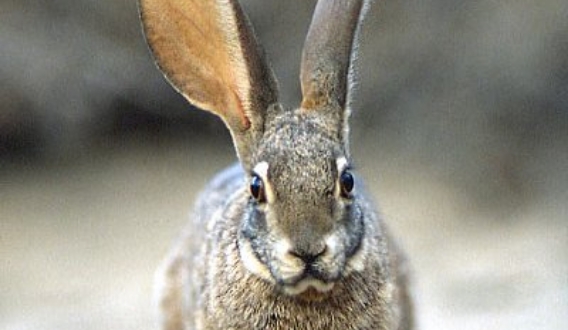
- What is the impact of jackal, leopard and caracal predation on Riverine Rabbit (Bunolagus monticularis) populations in the Nama and Succulent Karoo?
- What is the impact of predation by raptors on Riverine Rabbit (Bunolagus monticularis) populations in the Nama and Succulent Karoo?
- What are the habitat requirements and movement patterns of Riverine Rabbits in the Succulent Karoo?
- Can a machine learning protocol be developed to distinguish individuals of species without unique markings, such as Aardvark and Riverine Rabbits, captured on camera traps?
Drylands Conservation: Karoo Tortoises
Drylands Conservation:
Karoo Tortoises
Keywords/themes: restoration, predation risk, movement ecology, climate change, human-wildlife conflict, socio-economic development

- Which strategies most effectively mitigate crow predation on tortoises in the Nama and Succulent Karoo?
Drylands Conservation: Dryland restoration
Drylands Conservation:
Dryland restoration
Keywords/themes: restoration, predation risk, movement ecology, climate change, human-wildlife conflict, socio-economic development

- What are the most effective methods of habitat restoration in the Karoo?
- What are the survival rates of nursery-grown plants on restoration sites in the Nama Karoo, with and without protection?
- How do survival rates of two nursery-grown riparian plant species compare when planted in association with micro-catchments vs plough lines at two restoration sites in the Nama Karoo?
Drylands Conservation: Dryland agriculture
Drylands Conservation:
Dryland agriculture
Keywords/themes: restoration, predation risk, movement ecology, climate change, human-wildlife conflict, socio-economic development

- What methods could mitigate human-wildlife conflict and promote more ethical farming practices in the Karoo?
- Are Nama Karoo landowners aware of the impacts of climate change, and what are their adaptation and mitigation techniques to climate change?
- How do stakeholders respond to the Responsible Wool Standards Initiative, and do the standards result in a tangible benefit to biodiversity on
Drylands Conservation: Socio-economic development
Drylands Conservation:
Socio-economic development
Keywords/themes: restoration, predation risk, movement ecology, climate change, human-wildlife conflict, socio-economic development

- What is the long-term environmental impact of mining, agriculture and other development along South Africa’s West Coast?
- What are the gaps, weaknesses and strengths of existing water management policies and legislation, and how can they be improved for cooperative water governance around freshwater ecosystems in the Cape?
- What is the long-term environmental impact of mining, agriculture and other development in the Northern Cape?
- Using the Nieuwoudtville project as a case study, what are the socio-economic and environmental impacts of nature-based tourism?
Threatened Amphibian: Species
Threatened Amphibian:
Species
Keywords/Themes: freshwater ecology, flagship species, acoustic monitoring, citizen science, wetland ecology

- What is the current distribution of the elusive Amathole Toad (Vandijkophrynus amatolicus) in the Eastern Cape highlands?
- Can we use photographic recognition software to conduct a population census of the Endangered Western Leopard Toad (Sclerophrys pantherina) in the Western Cape?
- Can we use citizen science to conduct egg-clump counts and determine the phenology and population dynamics of the Endangered Kloof Frog (Natalobatrachus bonebergi)?
- Is acoustic monitoring a viable technique to determine population estimates and densities of the Endangered Pickersgill’s Reed Frog (Hyperolius pickersgilli)?
Threatened Amphibian: Habitats
Threatened Amphibian:
Habitats
Keywords/Themes: freshwater ecology, flagship species, acoustic monitoring, citizen science, wetland ecology

- Can we develop a tool to use frogs as indicators of freshwater health?
- What is the resilience of wetland ecosystems in KwaZulu Natal in the face of climate change?
- Can comparative studies of social and ecological assessments be used to determine the effectiveness of restoration for socio-ecological resilience?
Wildlife and Transport: Expand the scope and focus of roadkill studies in South Africa
Wildlife and Transport
Expand the scope and focus of roadkill
studies in South Africa
Keywords/themes: roadkill, mitigation

- Expand the scope and focus of roadkill studies in South Africa
- How applicable is the EWT’s roadkill monitoring protocol in various habitats and circumstances? How might the protocol be modified to improve its reliability?
- What rates of roadkill are observed in various habitats?
- Assess the use of existing mitigation options for roadkill
- Which existing structures facilitate wildlife crossings? What species use them? How might structures be altered to increase their use? What are the costs associated with these alterations?
- What are the indirect impacts of fences designed to prevent the movement of animals across road infrastructure?
- Can different odours be used as a repellent for livestock species grazing on roadside verges and prevent them from wandering onto the road and causing road accidents?
- Determine whether deliberate collision is a threat
- Is there a correlation between the locality of the research (urban, rural, agricultural etc.) and the type of animal deliberately hit (e.g., jackals are considered pests by some farmers)?
- Assess the use of roadkill for muthi
- What percentage/number of animals used by sangomas for muthi purposes are sourced from roadkill?
- What freshness of carcass is required by the sangomas?
- Does sourcing wildlife from roadkill victims reduce the need for alternative harvesting mechanisms?
- Monitoring the impacts of roads on Serval on the N3 highway, South Africa
- Serval have been documented as impacting roads on the N3 highway, with over 80 killed over two years. What impact does this have on the population?
- What are Servals’ behaviour around roads in general? Is it determined by prey base?
- Monitoring the impacts of roads on Bat-eared Fox on the R360, South Africa
- Bat-eared Foxes have been documented as being impacted on the R360 road. What impact does this have on the population?
- What is Bat-eared Fox behaviour around roads in general? Is it determined by prey base?
- What species are attracted to or repelled by roads and/or rail? Use of spoor surveys adjacent to and buffering (e.g. 100m and 1 km away) these two linear infrastructures can indicate species behaviour around them to generate an understanding of specific species that avoid or are attracted to linear infrastructure and the potential barrier effects.
- Does driver behaviour change in response to roadkill signage on rural roads?
Wildlife and Energy
Wildlife and Energy
Keywords/Themes: electrocution risk, bird mortalities

- Can key morphometrics of birds of prey be used as an identification technique for carcasses?
- Can power pole density be a surrogate for avian electrocution risk in southern Africa?
- Can remote sensing tools help identify electrocution risk for birds based on the identification and mapping of distribution power poles using satellite imagery?
- The development of a practicable remote bird collision monitoring system – real-time HD video stream covering several power structures and collision vibration detection.
- What is the physiological effect on birds from the electromagnetic fields produced by electrical infrastructure?
Wildlife in Trade: Illegal trade in wildlife
Wildlife in Trade:
Illegal trade in wildlife
Keywords/themes: illegal wildlife trade, pangolins, poaching, rhinos, wildlife consumption, smuggling, responsible tourism, alternative livelihoods

- How has Covid-19 lockdown and global travel restrictions affected wildlife crime? Are poachers becoming more creative, using new means to transport products when international travel is limited?
- Have the bans on wildlife consumption, first in China and increasingly in other countries, affected the scale of illegal wildlife trade sourced in Africa, specifically from South Africa?
- To what extent has the legal trade in lion bones contributed to the poaching and smuggling of wild lions? What is the conservation impact of the captive lion industry? What are the uses for lion parts in Africa and Asia?
- How many Temminck’s Ground Pangolins (Smutsia temminckii) are being removed from the wild every year in South Africa? Who is responsible, why, and how do we reduce the impacts? How do these removals affect the wild population?
- Which bird species are being removed from the wild in South Africa for illegal trade, and in what quantities are they being extracted? What are the impacts on wild populations? Is the illegal trade being conducted at subsistence or organised level?
- Which reptile species are being removed from the wild in South Africa for illegal trade, and in what quantities are they being extracted? What are the impacts on wild populations? Is the illegal trade being conducted at subsistence or organised level?
- What other animal taxa, for example, insects, are being exploited for the illegal wildlife trade, and what is the conservation impact?
What is the scale of the illegal trade in medicinal plants? - What are the transport routes of illegally traded cycads, and what is the volume of cycads smuggled out of the country versus retailed domestically?
- How often do timber cargo ships call into South African ports en route to Asia, and can the waybill information for each of these ships be analysed to determine timber species composition, volumes, sources, etc.?
- When looking at community engagement in wildlife trade, both in promoting sustainable, legal trade, and discouraging unsustainable, illegal trade, what lessons can be learnt? Can we apply these lessons to address wildlife crime at the source and, through doing so, explore possibilities for alternative livelihood options for people who may have once relied on illegal wildlife trade?
- How would the market for rhino horn respond if international trade were legalised? Will demand change? Will poaching increase or decrease? Will the black market for rhino horn still exist?
- What are the drivers of demand for the rarest and endangered animals or plants?
Regarding smuggling methods and routes:
- Which are the most likely routes (ports of entry and exit) for animal and plant products in Africa for the muthi trade?
- What methods are used at ports of entry and exit to detect illegal wildlife and wildlife products?
- How effective are the current detection methods, and how can they be improved?
- How are wildlife and wildlife products smuggled into and out of South Africa?
- Which ports of entry and exit are currently the most vulnerable to the illegal international trade in wildlife and wildlife products?
- What are the supply chains and trade routes of illegally traded wildlife products?
- Corruption is a major problem in the illegal wildlife trade because it impedes the effective implementation of the law. What can be done to reduce or prevent corruption among law enforcement officials dealing with wildlife products, and what is currently being done?
Wildlife in Trade: Responsible tourism
Wildlife in Trade:
Responsible tourism
Keywords/themes: illegal wildlife trade, pangolins, poaching, rhinos, wildlife consumption, smuggling, responsible tourism, alternative livelihoods

- How do wildlife-based tourism facilities advertise their activities to international and domestic tourists?
- What role does the tourism hospitality sector play in influencing where their guests go to enjoy our wildlife?
- What role can international tourists play in improving the responsibility of the wildlife-based tourism sector towards biodiversity and conservation of our environment?
- What role can domestic tourists play in improving the responsibility of the wildlife-based tourism sector towards biodiversity and conservation of our environment?
- How can we encourage both domestic and international tourists to become more responsible in their choices of wildlife-based tourism
Wildlife in Trade: Wildlife economy
Wildlife in Trade:
Wildlife economy
Keywords/themes: illegal wildlife trade, pangolins, poaching, rhinos, wildlife consumption, smuggling, responsible tourism, alternative livelihoods

- What are the conservation benefits/impacts of different wildlife-based land use enterprise types (e.g. hunting, breeding, tourism, meat production) within the private wildlife sector, and how do these compare to other (non-wildlife) land use activities (such as livestock production, crop production etc.)?
- What are the socio-economic benefits of trophy hunting, and how do these compare to other (non-wildlife) land use activities?
People in Conservation: Responsible tourism
People in Conservation:
Responsible tourism
Keywords/Themes: biodiversity stewardship, ecotourism, responsible tourism, livelihoods, communities

- Ecotourism and responsible tourism have long been regarded as a means of reducing poverty and generating livelihoods for the rural poor. What are the experiences and lessons learned through developing tourism enterprises as a poverty alleviation mechanism in different regions and settings in South Africa?
- What are the impacts of ecotourism or responsible tourism ventures on the communities they are situated in? Do experiences differ across types of tourist offerings? How do these compare with experiences elsewhere in Africa?
People in Conservation: Biodiversity stewardship
People in Conservation:
Biodiversity stewardship
Keywords/Themes: biodiversity stewardship, ecotourism, responsible tourism, livelihoods, communities

- Biodiversity stewardship is a mechanism that aims to improve the conservation of priority biodiversity areas through the development of agreements between conservation authorities and private and communal landowners. Do landowners benefit from these agreements? Are these benefits sufficient to motivate landowners to re-commit to biodiversity stewardship once the agreement expires?
- What factors contribute to the long-term implementation of effective biodiversity stewardship agreements?
- What were the processes and experiences of parties leading to the development of Biodiversity stewardship agreements by different groups of communal landowners? What were the key lessons learned during the development of the agreements? Did anticipated benefits materialise in the post-declaration period? What were the key lessons, benefits and challenges?
Biodiversity Data
The EWT Biodiversity
Databank
One of our most valuable assets is our Biodiversity DataBank. The DataBank is the central storage location for all ecological and spatial information within our organisation and our numerous partners. It includes datasets covering species, habitats, and threats to wildlife and humans. Our Conservation Planning and Science Unit maintains our centralised Biodiversity DataBank, keeping the data accessible and storing it safely online.
Data Sharing
By sharing data, we allow researchers and conservation practitioners to expedite the conversion of primary research results into knowledge, products, and procedures to improve conservation initiatives. We believe we should make environmental data as widely and freely available as possible while safeguarding confidentiality and proprietary rights.
If you require biodiversity data we hold for use in Conservation Planning, Research, or Environmental Impact Assessments, please click here and fill in the data-sharing request form. Note that we can take one to four weeks to process requests for data, depending on the volume of data you request.
In addition to the datasets we produce, we work with external partners to collect, collate, manage, and share regional biodiversity datasets. We are an Associate Participant Node of the Global Biodiversity Information Facility (GBIF). A GBIF Participant node coordinates a network of institutions that produce, manage, and use biodiversity data. As a node, we commit to sharing and mobilising biodiversity data to support biodiversity-related science and decision-making for sustainable development.

Data Sets
Discover a fascinating collection of biodiversity data sets compiled through years of research, monitoring and field observations. Explore records covering species, wildlife, habitats and conservation threats across South Africa, with each resource available to download as a PDF.
EDUCATIONAL RESOURCES
Discover educational resources, activities and materials for learners,
educators and wildlife enthusiasts.
Nature & Science
Nature & Science
Learn about wildlife, habitats, and ecosystems
Creative Creatures
Tails & Trails
Tails & Trails
Learning through language: Literacy and comprehension, creative writing
exercises, stories from the bush, puzzles, and word searches